Well-informed, safe on the road, and fully immersed in nature
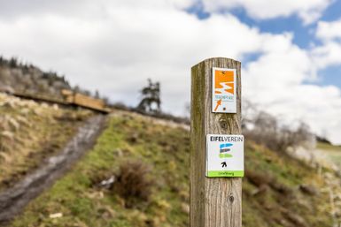
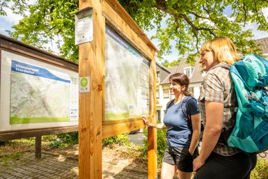
In the Eifel, we don’t leave your hiking experience to chance. Our trails are carefully inspected, clearly marked, and offer you the best conditions for carefree hikes through one of Germany’s most beautiful low-mountain landscapes.
Whether around Aachen in North Rhine-Westphalia, through the volcanic landscape of the Eifel, or all the way to Trier in Rhineland-Palatinate: On our website, you’ll find plenty of information about hiking in the Eifel, inspiring hiking tours, inspected trails, certified long-distance trails like the Eifelsteig, and high-quality loop trails for various skill levels.
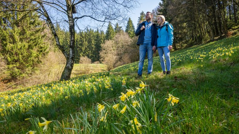
The Eifel is perfect for anyone looking to recharge their batteries outdoors: for ambitious athletes seeking challenging routes, as well as for mindful connoisseurs who want to consciously experience nature, sweeping views, forests, valleys, and quiet paths. Here, every step becomes an adventure.
And as your day of hiking slowly comes to a close, genuine Eifel hospitality awaits you: warm hosts, regional cuisine, and cozy accommodations where you’ll feel completely at home after your hike. This is how your hiking vacation in the Eifel becomes a journey you’ll never forget.
A one-day hike in the Eifel is not enough for you and planning a multi-day hike is not in your schedule? Then we have the right thing for you.
We can organize your accommodation and, if you wish, your luggage transfer for our multi-day hiking vacations. All you have to do is arrive, start hiking and of course enjoy and relax.
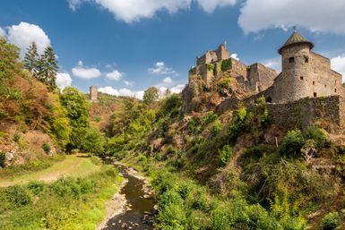
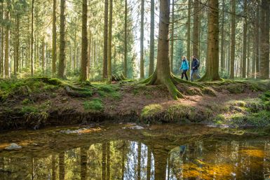
With its 313 kilometers, the Eifelsteig is one of the most beautiful long-distance hiking trails in Germany. Whether you start your hike in Aachen in North Rhine-Westphalia or in Trier in Rhineland-Palatinate - in 15 stages of between 15 and 28 kilometers, you will hike through the unique and historic landscape of the Eifel.
On the Eifelsteig, you hike through the most beautiful landscapes of the Eifel. You cross the Eifel National Park, the only national park in North Rhine-Westphalia, and experience the large reservoirs of the North Eifel. In addition to huge limestone reefs, you will also pass the maars of the Eifel on your hike, which invite you to stop and take a look. Just before Trier, the red sandstone formations from which the Porta Nigra in Trier was built are impressive.
Whether as a multi-day tour or just individual stages, the Eifelsteig has the right tour for you.
Copyright: Eifel Tourismus, Dominik Ketz
The Eifelsteig
313 km - 15 stages - Premium hiking trail from Aachen-Kornelimünster to Trier
Hiking in the Eifel is always varied and exciting. Hike slowly through unspoilt nature, leave the hustle and bustle of everyday life behind and discover the beauty to the left and right of the path. The Eifel has many different landscapes to offer that have been created by the interplay of the elements - from the Eifel National Park to the High Fens, the Volcanic Eifel, the Bitburger Gutland or the rocky landscapes on the border with Luxembourg.
Whether circular trails for a day trip or tours lasting several days - all hiking trails are laid out according to the criteria of the German Hiking Association or the German Hiking Institute and are characterized by hiking quality. Our trail patrons guarantee a carefree hiking experience. All paths are checked, marked and, if necessary, minor detours lead to the destination.
Then take a look at our complete collection of hiking trails in the Eifel. Whether leisurely or sporty, short or long - you are guaranteed to find a tour that suits you.
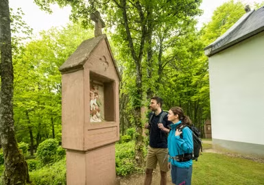
Hiking with children? Of course - it's fun for the whole family!
The Eifel not only offers hiking routes for ambitious sports enthusiasts, families with children will also find the right tour in the Eifel. Whether on the "Traumpfad Vulkanpfad" or the "Bollendorfer Märchenpfad" - there is a suitable tour for everyone here.
Copyright: Eifel Tourismus, Dominik Ketz
Family-friendly hikes
All family-friendly hikes are shorter than 15 km. There is plenty to discover for young and old. Go on an exciting journey of discovery and get to know the flora and fauna of the Eifel.