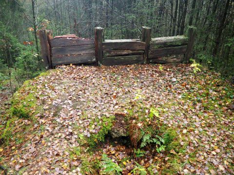
Copyright: Foto: Laura Rinneburger, Quelle: Touristik-Büro Vordereifel
Ettringer Bellerberg - Vulkanparkstation
Ettringen
The Bellerberg volcano, a cinder cone typical of the Eastern Eifel, formed 200,000 years ago. The “Ettringer Bellerberg” and the “Kottenheimer Büden” form the western and eastern flanks of the large Bellerberg volcano.
From the 428-meter-high summit of the “Ettringer Bellerberg,” you have a fantastic view across the volcano’s actual “crater” to the surrounding volcanic Eastern Eifel.
To get a feel for the region, take a hike along the approximately 7-kilometer-long “Vulkanpfad” (Volcano Trail), a scenic path that offers a unique journey through 200,000 years of Earth’s and human history (approx. 2 hours). The “Vulkanpfad” connects three of the Volcano Park’s landscape monuments: the “Ettringer Bellerberg,” the “Kottenheimer Büden,” and the “Kottenheimer Winfeld.”
Information on all the Volcano Park’s stops is available here!
GPS coordinates: N50°21.118' E007°13.683'
Impressions
Copyright: Foto: Laura Rinneburger, Quelle: Touristik-Büro Vordereifel Copyright: Foto: Laura Rinneburger, Quelle: Touristik-Büro Vordereifel Copyright: Foto: Laura Rinneburger, Quelle: Touristik-Büro Vordereifel Copyright: Foto: Laura Rinneburger, Quelle: Touristik-Büro Vordereifel Copyright: Foto: Laura Rinneburger, Quelle: Touristik-Büro Vordereifel


Contact

Ettringer Bellerberg - Vulkanparkstation
Am Beller Berg
56729 Ettringen