Ti Bitburger Land_MM (27)-2")
Copyright: TI Bitburger Land
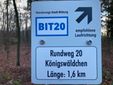
Wanderroute Königswäldchen Bitburg
Type of tour:Hiking
-Difficulty:very easy, easy
Duration0:25 h
Length1.6 km
Ascent16 hm
Descent16 hm
Elevation profile
Description
Barrier-free circular route through the "Königswäldchen" city forest, accessible with a wheelchair and baby carriage.
A C H T U N G
Dear forest visitors
The forest was severely damaged by the dry years 2018 to 2022. Some of the copper beeches and pines in the Königswäldchen are dying.
Particularly in windy conditions, branch breakage, crown breakage and falling trees are to be expected. Please be aware of these and other forest hazards when visiting the forest.
Please note that the town of Bitburg is not liable for forest hazards.
Bitburg, May 2024 - Forestry district - Bitburg Steinborn
----------------------------------------
The Königswäldchen, a small oasis close to the town: relaxing birdsong and rustic forest sections accompany you on the easily walkable and navigable path. Here and there you pass stations on the forest adventure trail. And with a bit of luck, hikers will see the beautiful face of wild orchids in the spring months.
The Königswäldchen is located on the L32.
The circular trail is marked with BIT20.
Impressions
TI Bitburger Land (1)-2")
Ti Bitburger Land_MM (16)-2")
Ti Bitburger Land_MM (1)")
TI Bitburger Land")
TI Bitburger Land (3)")
Further information
Travel-for-all information
We have compiled some information on accessibility below. Detailed information can be found in the test report.
- The circular route has a total length of 1.6 km.
- The hiking trail is not designated for other user groups.
- The trail is signposted. However, the signposting is incomplete.
- There is no information in easy language.
We have compiled some information on accessibility below. Detailed information can be found in the test report.
- The circular route has a total length of 1.6 km.
- The path is signposted. However, there are gaps in the signage.
- The hiking trail is not signposted for other user groups.
We have compiled some information on accessibility below. Detailed information can be found in the test report.
- The circular route has a total length of 1.6 km.
- The path does not have a continuous visually contrasting or tactilely detectable walkway boundary.
- The trail is not designated for other user groups.
- The path is signposted. However, there are gaps in the signage.
- The signage is designed in easily legible and high-contrast lettering.
- Information is not available in Braille or prismatic writing.
We have compiled some information on accessibility below. Detailed information can be found in the test report.
- There are two marked parking spaces for people with disabilities at the starting point of the hiking trail.
- The circular route has a total length of 1.6 km.
- The path is stepless.
- The path is at least 165 cm wide, mostly wider.
- It is partly not easy to walk and drive on (water-bound surface, forest paths, partly gravel).
- It has a number of inclines and declines. The steepest incline is 13% over a length of 50 m (gradient). The longest section with an incline is 150 m long and has a gradient of 5%. There are also cross slopes of up to 5%.
- Seating is available.
- The path is signposted. However, there are gaps in the signposting.
- The hiking trail is not signposted for other user groups.
- There is no WC along the trail.
- The Bitburger Land tourist information office rents out Swiss Tracs and a wheelchair. Details can be found on the Bitburger Land Tourist Information website.
- Certified in the period: September 1, 2023 to August 31, 2026


