All hiking trails | Hiking | Holidays in the Eifel
Wandern durch die hügelige Landschaft der Eifel, © Eifel Tourismus GmbH, Dominik Ketz

Eifel hiking trails

HIKING THROUGH IMPRESSIVE NATURAL LANDSCAPES

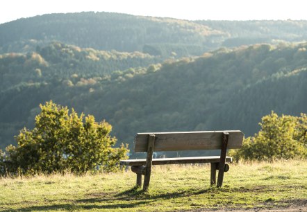
The uplands between Aachen, Cologne, Koblenz and Trier are of interest for their varied landscape and cultural history. They offer the ideal setting for a hiking holiday.
Breathtaking natural landscapes are waiting to be discovered on a hiking tour of the Eifel! Visit the ancient beech and oak forest in the Eifel National Park, the high moorlands of the “Hohes Venn - Eifel” high fen natural park, the enormous reservoirs in the North Rhine-Westphalian Eifel region, the maars in the Volcanic Eifel natural  and geopark, the fertile “Bitburger Gutland” with its orchards, the wild, craggy rocky landscape of the Ferschweiler plateau and the wide open plateaux of the wild Islek region in the South Eifel natural park, or the East Eifel, once covered by glowing lava and still dominated today by volcanic cones and crater lakes. 

It’s well worth stopping along the way to visit the picturesque Eifel towns with historic town centres, half-timbered houses dating from the Middle Ages, Roman walls, rugged castles and splendid palaces. Another special experience for hiking enthusiasts!
The Eifel has many facets, and it’s worth considering hiking routes through both North Rhine-Westphalia and Rhineland Palatinate. A large number of trails are available to choose from when planning your tour.


mehr lesen

Share content:

Bitte akzeptieren Sie den Einsatz aller Cookies, um den Inhalt dieser Seite sehen zu können.

Alle Cookies Freigeben

Active filter

  • Sort by "by chance"

Filter results

ET-2022-144-Schrauffweg Püngelbach-@Eifel Tourismus GmbH, Dominik Ketz, © @Eifel Tourismus GmbH, Dominik Ketz

65 Dorfrundgang - Erkensruhr

Lenght: 6.7 km
Difficulty: easy

More information
The pilgrimage chapel of St. Jost an der Nitz, © Laura Rinneburger

Jodokusweg in Langenfeld/Eifel

Lenght: 11.1 km
Difficulty: medium

More information
Aussichtspunkt Kuckucksley, © Eifel Tourismus GmbH, Dominik Ketz

Rur-Olef Route

Lenght: 57 km
Route: Gemünd to Gemünd
Difficulty: medium

More information
Hiking tour with a view of the Manderscheid castles, © Eifel Tourismus GmbH

County Route

Lenght: 14.2 km
Route: Kurhaus Manderscheid to Manderscheid
Difficulty: medium

More information
IMG_3696, © Rureifel-Tourismus e.V., Michelle Wiesen

Kall Trail [66]

Lenght: 8.8 km
Difficulty: medium

More information
philosopher's path, © Stadt Mayen

Philosophenweg

Lenght: 5.2 km
Difficulty: easy

More information
View over the garden fence on the Vulcano Trail hiking trail, © Eifel Tourismus GmbH, D. Ketz

Vulcano-Pfad

Lenght: 26.2 km
Route: Schalkenmehren to Schalkenmehren
Difficulty: difficult

More information
ET-2022-087-Simmerath-Eifelsteig Dedenborn-©Eifel Tourismus GmbH, Dominik Ketz, © Eifel Tourismus GmbH, Dominik Ketz

36 - Rur-Panoramaweg

Lenght: 6.5 km
Difficulty: medium

More information
Monreal castles in the fog, © Laura Rinneburger

Karbachtalweg in Monreal und Reudelsterz/ Eifel

Lenght: 7.7 km
Difficulty: medium

More information

Fledermausweg

Lenght: 1.2 km
Difficulty: easy

More information
Ginster auf der Eifelgold Route, © Eifel Tourismus GmbH, Dominik Ketz

Hiking tips for one-day hikes

SELECTED HIKES THROUGH THE EIFEL

More information