

Copyright: Eifel Tourismus., Dominik Ketz
Volcanoes and maars
The origin of volcanism in the Eifel
Volcanism in the Eifel began around 45 million years ago. The decisive factor was a strong stretching of the earth's crust in the course of the formation of the Alps, which triggered the first volcanic activities.
There are three volcanic fields in the Eifel, which can be distinguished spatially and temporally:
- the tertiary Hocheifel volcanic field
- the Quaternary volcanic fields in the West Eifel and
- the Quaternary volcanic fields in the Eastern Eifel.
First major volcanic phase in the Tertiary
The first phase of Eifel volcanism took place in the Tertiary period, between about 45 and 35 million years ago. It was concentrated in the area between Ulmen and Adenau - the so-called Hocheifel volcanic field. Over 400 tertiary volcanoes have been identified here. The Arensberg volcano near Hillesheim is evidence of this phase.
Second volcanic phase in the Quaternary
The second phase of Eifel volcanism began around one million years ago and lasted until around 10,000 years before today. The Quaternary volcanic fields in the eastern and western Eifel were formed during this period.
The present-day landscape of the Eifel was shaped during the Quaternary period. The Rhenish Slate Mountains rose again and rivers cut deep into the landscape. The cause of the volcanism of this phase is the formation of a so-called (mantle) plume. This is a zone of heated rock in the Earth's mantle beneath the crust of the Eifel. The magma of the Eifel volcanoes has been proven to come from there.
Volcanic activity in the West Eifel
Volcanic activity in the Western Eifel began around 700,000 years ago. Between Bad Bertrich in the south-east and Ormont in the north-west, there is a series of quaternary volcanoes about 50 kilometers long. This area is now part of the UNESCO Volcanic Eifel Geopark.
The best-known volcanic formations in the Western Eifel are the Eifel maars, which are occasionally filled with water and contain a maar lake.
The Laacher See volcano: center of the Eastern Eifel
Volcanism began in the Eastern Eifel around 500,000 years ago. Starting from the area of today's Laacher See, the activity extended as far as the Neuwied Basin. Larger quantities of basalt lavas, pumice and ash tuffs were extracted here than in the Western Eifel.
The dramatic climax was the eruption of the Laacher See volcano around 13,000 years ago. A huge magma chamber with a volume of over 6 km³ had formed beneath the earth's surface. The eruption hurled a 40-kilometre-high cloud of ash into the atmosphere, glowing streams of ash devastated the surrounding area and around 15 km³ of pumice and ash were dispersed. The rest of the existing earth's crust collapsed, creating a huge hole that filled with water, today's Lake Laach. An animation in the Lava Dome allows visitors to experience this volcanic eruption.
The volcanic field of the Eastern Eifel is now protected in the Laacher See National Geopark . Numerous stations in the volcano park are dedicated to life with the volcanic heritage - from historic mines to tunnels and quarries. They illustrate the long and impressive changes that the region has undergone as a result of volcanism.
Experience volcanism in the Eifel


Interesting Facts About the Eifel Volcanic Landscape
Volcanic activity in the Eifel began about 45 million years ago during the Tertiary period. A second, more recent phase took place during the Quaternary period and lasted until about 10,000 years ago.
Maars are funnel-shaped volcanoes formed by steam explosions. Many are now filled with water and are called maar lakes.
Gas bubbles (mofettes) still rise to the surface at Lake Laach today. They are considered evidence that volcanic activity in the Eifel has not yet completely ceased geologically.
Yes. Visitors can discover maars, craters, lava formations, and museums such as the Lava Dome, or explore numerous volcanic sites along the German Volcano Route.
The dramatic climax was the eruption of the Laacher See volcano about 13,000 years ago. This event gave rise to what is now Lake Laach.
In the Eifel, two geoparks tell the story of the region’s volcanic past:
- the UNESCO Vulkaneifel Geopark and
- the Laacher See National Geopark.

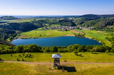
Lake Laach
Fancy a little journey through time? Mysterious gas bubbles rise up from Lake Laach - evidence of a huge volcanic eruption around 13,000 years ago. Discover the fascinating world of mofettes, hike along the Pellenzer Seepfad trail and visit the impressive Maria Laach Abbey.


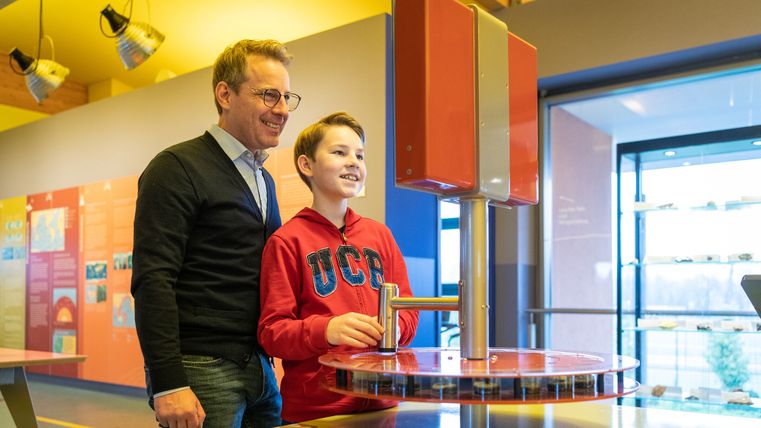
Volcanism museums


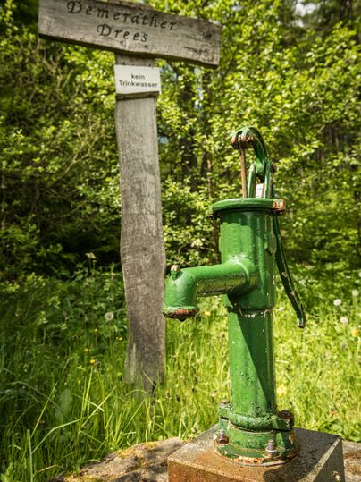
Mineral water: sparkling Dreese in the Eifel


German Volcano Route
Want to take the grand tour and delve deep into the volcanic history of the Eifel?
The signposted “Deutsche Vulkanstraße” (German Volcano Route), a vacation and adventure route, takes you to geological, cultural-historical, and industrial-historical sites related to Eifel volcanism.


